
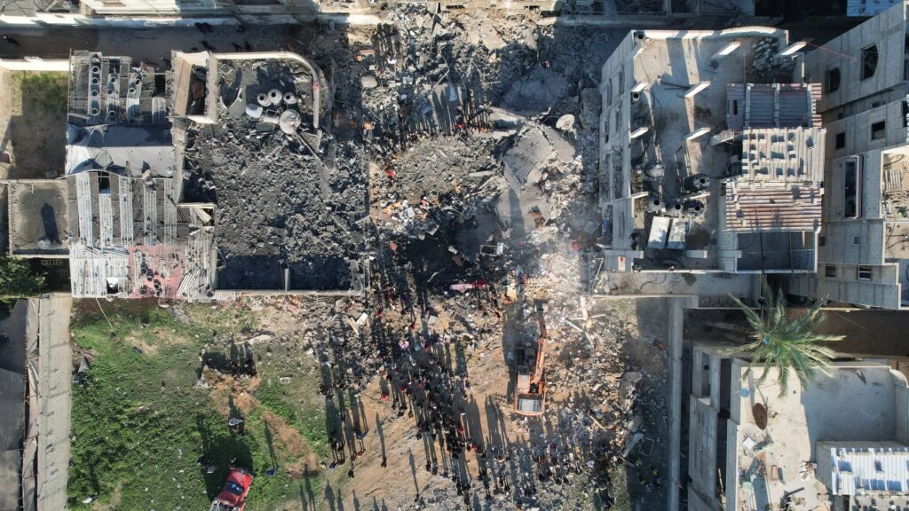
New satellite imagery updated on Google Maps has laid bare the extensive scale of destruction across the Gaza Strip nearly three years into the conflict, with further damage to homes, businesses, places of worship, and infrastructure visible even after a fragile ceasefire took effect almost a year earlier.
The images, primarily captured around June 2026 (with some areas showing February 2026 data), were widely noticed in late September 2026. They reveal entire neighbourhoods reduced to rubble, roads cutting through once-dense residential areas, and vast tented camps lining the shoreline. According to reporting by The Guardian and other outlets, the visuals highlight the severity of the ongoing humanitarian crisis facing Gaza’s approximately 2.3 million residents.
In Al-Mawasi, Rafah, areas that were relatively open in 2023 are now densely packed with tented camps stretching along the coast, often just metres from the sea.
Tel al-Sultan in Rafah appears largely flattened, with few buildings remaining standing where dense housing once existed.
Northern towns such as Beit Lahiya and Beit Hanoun show massive damage.
The Istiqlal Mosque in Khan Younis and major Gaza City neighbourhoods including Jabaliya and Shuja’iya are clearly uninhabitable in the latest views.
Gaza’s main port is damaged and largely empty of fishing boats, surrounded by makeshift shelters.
United Nations data underscores the scale. The UN agency for Palestinian refugees (UNRWA) and the UN Satellite Centre (UNOSAT) report that about 82% of structures in Gaza — roughly 200,000 buildings — have been damaged, with approximately two-thirds of those destroyed. A recent assessment estimated that the number of destroyed structures increased by around 9% since the ceasefire declared in October 2025. More than 2.1 million people remain displaced, Livingston in tents and temporary shelters.
The UN Development Programme has estimated the total rubble in Gaza at about 61 million tonnes — roughly 20 times the amount generated in all wars worldwide over the previous 18 years. Agricultural land has also been heavily affected, with large areas of greenhouses and farmland reduced to barren ground.
Analysts and observers note that satellite imagery remains one of the primary ways to assess conditions on the ground, given limited access for international journalists. The updated Google Maps layers have prompted widespread discussion on the continuing impact of the conflict and the challenges of reconstruction.
The imagery serves as a stark visual record of the physical toll on Gaza’s civilian infrastructure, places of worship, and residential areas amid the fragile ceasefire period.